ENG
|
Geographical location
of Medjugorje - map and description
|
|
Interactive map of Medjugorje |
|
|
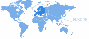
Medjugorje is located in
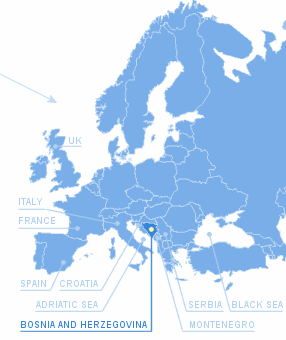
the southwestern region of Bosnia and Herzegovina, country on
the Balkan peninsula, Southeastern Europe. The Balkan Peninsula
is located between the Adriatic and Black sea. |
| |
|
 |
 |
|
Bosnia and
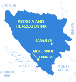
Herzegovina is bounded by Croatia on the north
and west (border length 932 km), by Serbia on
the east (border length 312 km) and by
Montenegro on the southeast (border length 215
km). Air distance by geographical latitude and
longitude is north-south 314 km and east-west
309 km. Bosnia and Herzegovina covers totally
51.209,2 km2. Clime in Bosnia is majority continental, and
mediterranean on south (Herzegovina), where is
located Medjugorje.
Capital city is Sarajevo. Official languages are
bosnian, croatian and serbian. |
|
|
|
 |
The parish of
Medjugorje is situated in the region called Herzegovina,
25 km southwest of Mostar. Herzegovina is situated
between two regions: a mountainous region to the north
and a coastal region to the south. The mountainous wall
to the north holds back the circulation of atmospheric
masses from the Mediterranean, creating favourable
climatic conditions for various vegetal cultivations in
the area of Herzegovina. The whole region is inhabited
by Croatians who received Christianity 13 centuries ago.
The present parish was founded in 1892 and dedicated to
St. James the Apostle, protector of pilgrims. |
|
| |
|
The name MEDJUG0RJE is of
Slavic origin and it means "area between two mountains". The
territory of the parish spreads out at the altitude of 200
meters above sea level and has a mild Mediterranean climate. The
population currently numbers about 4300 inhabitants. In
historical documents, the village was mentioned in 1599 for the
first time. |
|
Medjugorje - live
(Hrv, Eng, De, It, Fr, Esp, Pol,
Sk, Kr, Ru)
|
|


